DESIGNED SPECIFICALLY FOR THE MĀNOA VALLEY CAMPUS
EMBODYING A “NATIVE HAWAIIAN PLACE OF LEARNING”
The University of Hawaiʻi at Mānoa Wayfinding & Signage System orients campus visitors to the geographic layout of the university and its institutional history, while recognizing the ʻāina we are situated upon and prioritizing Kanaka ʻŌiwi (Native Hawaiian) navigational practices, epistemologies, and moʻolelo.
-
Part of University of Hawaiʻi at Mānoa’s long-term plan is grounded in a commitment to becoming a “Native Hawaiian Place of Learning,” all the while enhancing student success, creating spaces for research excellence, and building a sustainable and resilient campus environment. Thus, as an Indigenous student-serving institution, it’s vital to integrate deeply-rooted Kanaka ʻŌiwi cultural practices and perspectives into campus experiences.
To do this, the Wayfinding & Signage System addresses the question of “Where am I?” at multiple, intersecting levels: Where am I physically standing on campus, and in relation to other significant places in and around Mānoa Valley? How do I get to where I’m going on campus? What is the significance of where I am standing? What should I know about the valley’s vegetation—like the kalo that continues to thrive here—and its stories?
“The aim of each design is to reinforce cultural values. Here on campus, our goal is to remind students, teachers, and the general community, that the greater purpose is to practice culture.
We hope they carry forth the knowledge, even if only subliminally, the importance of place and its culture, to absorb art and stories, and to share it. We seek to educate and inspire this community. The goal is for them to develop their own communities and share this knowledge.”
‘ILI BOUNDARIES & NAVIGATION LINES
UNDERLYING LOGIC SYSTEMS ARE REVEALED
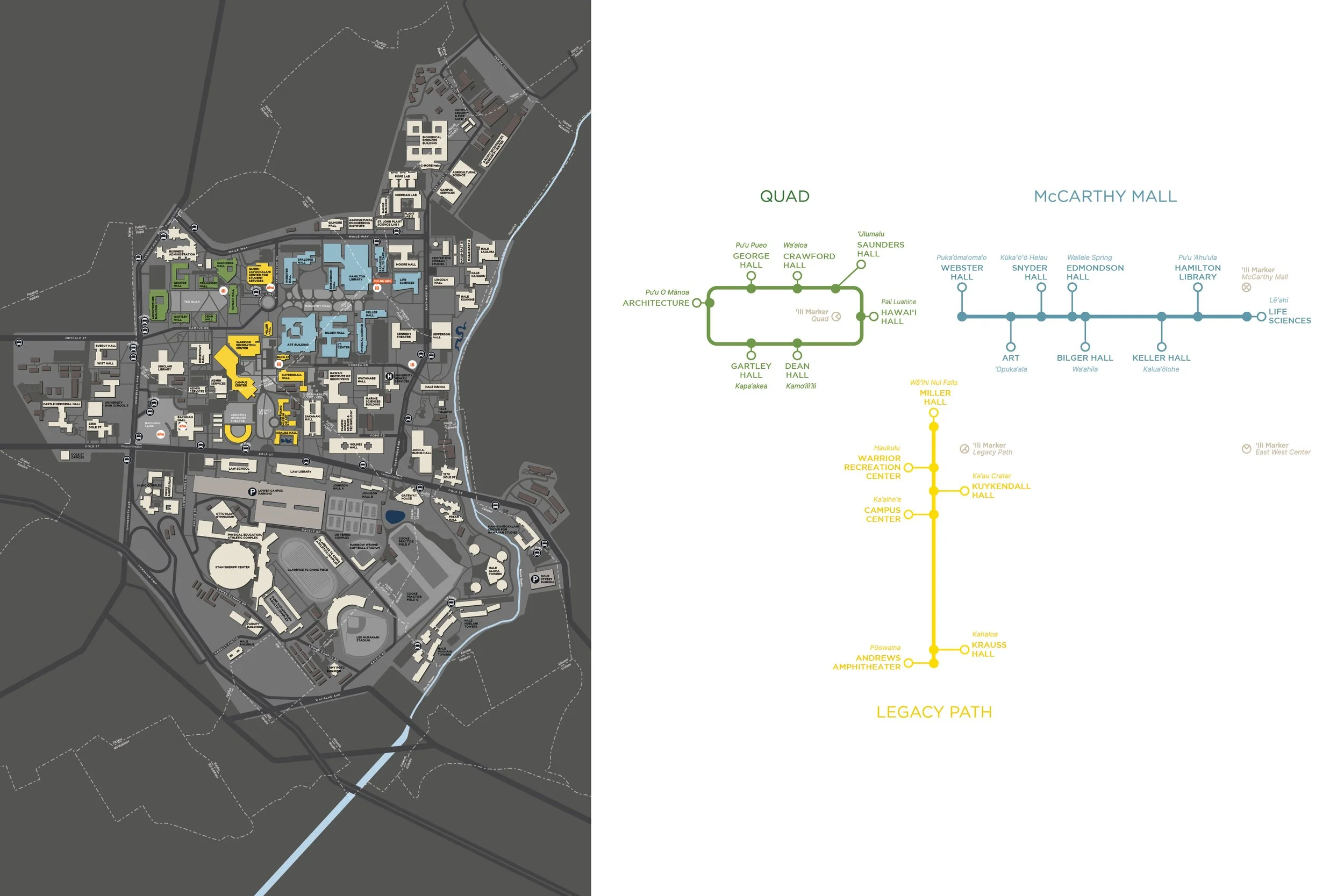
The building signs around campus are located along three main pedestrian axes to help guide visitors through campus. These axes overlay numerous ʻili lines that crisscross throughout Mānoa Valley. An ʻili marks the smallest subdivision of land within the Hawaiian land division system and, together, these two types of mapping—along campus axes and historic, Kanaka land organization—help visitors understand this unique place more deeply.
VIDEO COMING SOON
MĀNOA VALLEY IS CONNECTED TO A NETWORK OF WAHI PANA
WAHI PANA INVITE VIEWERS TO LEARN MORE ABOUT KANAKA 'ŌIWI ALIGNMENT PRACTICES AND POLYNESIAN NAVIGATION TECHNIQUES
Wahi pana, or storied places, are significant locations that hold an abundance of stories and memories, often passed down from generation to generation. Each building sign has been paired with a bronze medallion set into the sidewalk which features an outline of the star compass and a puʻu (pointer) marker. When viewers align their bodies with the medallionʻs puʻu, theyʻre directed to a specific wahi pana near campus.
VIDEO COMING SOON
VIDEO COMING SOON
DESIGN ELEMENTS & SYSTEM COMPONENTS
BOTANICALS & GEOMETRIC ARTWORK CONNECT VIEWERS TO ‘ĀINA
Building signs have been carefully designed to highlight vegetation found in and around Mānoa Valley. Each botanical was chosen for its meaning to, and relationship with, Kanaka ʻŌiwi as many of these plants are also recognized as kinolau, one of the many embodiments of akua (elemental forces). A unique watermark pattern on the signs, inspired by handmade kapa textiles, also symbolically ties to water, wayfinding, and relationships.
VIDEO COMING SOON
VIDEO COMING SOON


